At IAB, we attempt to portray a picture of Iran, its people, its history, religion and culture as accurate as possible based on historical facts. The intention is simply to give a brief history and reasons of how we Iranians became who we are as a people. Hopefully, readers, especially the Iranian youth, will gain a better understanding of the people of Iran and their nation.
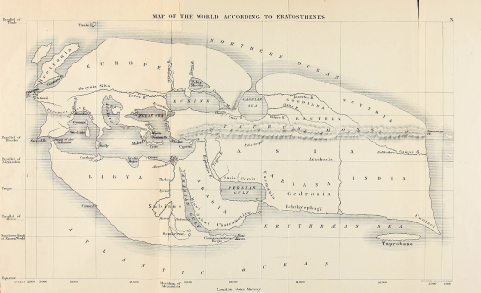
The name Iran denotes the land of the Aryans. The meaning of the word “Aryan” is noble or najib in Farsi. The Aryans were the people who came from central Asia and settled in the Iranian plateau about four thousand years ago. Prior to 1935, Iran was known as Persia. In 1935, under the reign of Reza Shah the name was changed to “Iran” since Persia implied the “Fars province” rather than the whole nation. After the 1979 Islamic Revolution, the name was changed to “The Islamic Republic of Iran”.
Today’s Iran has an area of 1,648,000 sq. km. or 636,296 sq. mi. (roughly 1/6 of the US land mass). It is located in the southwestern part of Asia. To the north of Iran lie Azerbaijan, the Caspian Sea and Turkmenistan. The neighbors to the east are Turkmenistan, Afghanistan and Pakistan. To the south are the Sea of Oman and the Persian Gulf. To the west are countries of Iraq and Turkey. Iran has 1650 miles of coastline and the country is connected to the open seas through the Persian Gulf and the Oman Sea.
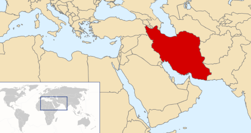
Iran can be divided into four regions: the Interior Plateau, the Mountains, the Caspian Sea Coast and the Khuzestan Plain.
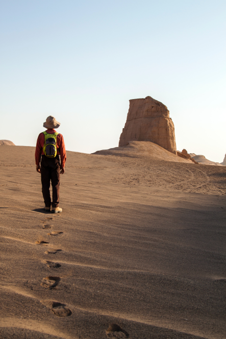
The Interior Plateau covers more than half of the country and within it there are two large uninhabitable deserts, Dasht-e Kavir and Dasht-e Lut that together covers more than 38,000 sq. miles. The plateau is over 3000 ft. above sea level and it is within an area in the shape of a large inverted V, formed by the two snow capped mountain ranges of Elburz in the north and Zagros in the east. Most of the major cities such as Tehran, Mashhad, Tabriz, Isfahan, Shiraz and Hamadan are located on this plateau. These cities are high in altitude and range from 3200 to over 6000 ft. above sea level.
Of course, the high altitude lowers the temperature at which the water boils and among other things it lengthens the cooking time of food. The Elburz range with its highest peak, Damavand (over 18,300 ft. and volcanic) is a continuation of the Alps in Europe and the range goes through Afghanistan and finally connects to the Himalayas. Most of the population lives in cities and villages on this plateau. Outside the plateau are the populated areas of Khuzestan and the Caspian Sea.
Iran’s climate varies from region to region. Temperatures in the northwest mountains drops to -20 o F in the winters and the summers are mild. However, the Khuzestan plain has very hot and humid summers (over 95 o F). The hottest point on earth has been recorded in the Iranian great desert, of Dasht-e Lut, with a temperature of 60 o C or 140 o F. Because of the low annual snow- or rain-falls in most of Iran (between 2 to 9 inches), water is scarce in much of the country.
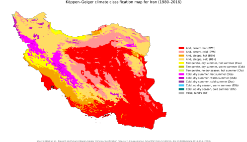
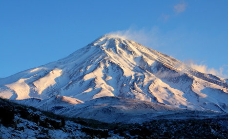
However, the Caspian Sea area has an annual rainfall of about 40 inches, has mild temperatures and is lush green. Except for a few cities that have their water sources from the rivers, dams and lakes, the majority of cities and some villages get their water from wells. Irrigation is used for most of the farming and in the villages, especially for farming, water is supplied through springs or qanats. Qanat or kariz is a system that was probably invented by the Persians several thousand years ago, where water from its source, usually the foothills of a mountain is brought to the surface for use through underground canals.
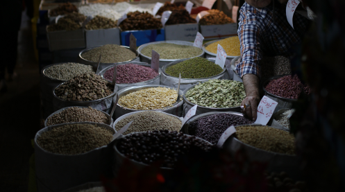
Less than 13% of the land in Iran is suitable for farming. The agricultural products of Iran are wheat, barley and various kinds of fruits and vegetables. The Caspian Sea area is known for its rice, cotton, tea and citrus fruits, and the southern part of Iran is known for citrus fruits and dates. Saffron is mainly produced in the province of South Khorassan and the Kerman area is famous for its delicious pistachios. Iran is well known for its caviar, pistachios, saffron, its beautiful handmade carpets and oil as well as minerals.
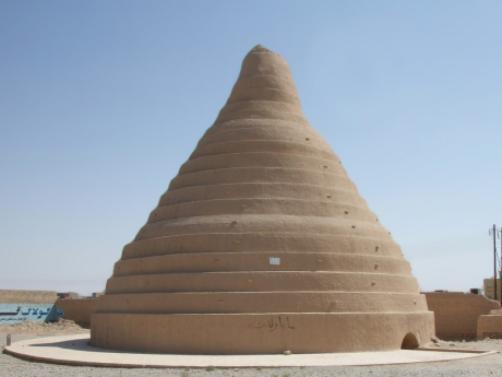
From the time of antiquity, the Iranian people had been ingenious in using the natural forces, such as wind, gravity and flowing water to improve their way of life. Examples are the system of qanats previously described, wind mills, water mills and wind chimneys. Falling waters and winds are used to run mills for grinding wheat, the main staple of the people’s diet. Another use of the wind is for cooling houses in the hot summers by way of wind chimneys (baadgirs) on the roofs, a common feature, in old cities such as Yazd and Kashan. The Iranians may have also been the first people to build dams as well as transporting water from these dams or rivers to other locations by way of canals. This is seen in many existing ancient dams and miles of old canals.
Ancient Persians were very conscientious in preserving the environment. This is seen in the method by which they disposed of their dead. They placed the dead in a tower, called the Silent Tower, where vultures devoured the flesh and then the bones were treated and destroyed by lime or kept in a high place. Also, they were highly respectful of bodies of water, and in order not to pollute them they did not swim in them and removed the water and used it for cleaning and cooking away from the water source.

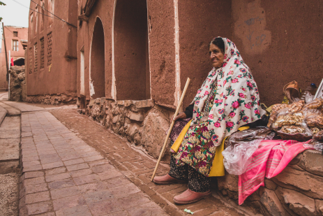
Nearly all the Iranians, with the exception of some Arab tribes in Khuzestan, are Aryans, a branch of the Indo-European race. The Indo-Europeans originated from the Caspian Sea area or Caucasus region and then spread over the Iranian Plateau, Indian continent, Eastern and Western Europe and then Americas. Because of their origin, they are also called Caucasians. The language of the Iranians is Persian or Farsi, and belongs to the family of the Indo-European languages. Because of their common roots, Farsi in its structure and vocabulary is similar to Indian, European and Slavic languages.
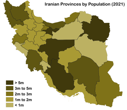
Iran has a population of over 79 million (50.7% male and 49.3% female). More than 71% of the population lives in the cities. The present birth rate is only 1.25% and this rather low rate is reflects a low rate of marriage due to many factors including unemployment, the high cost of living and housing. More than half of the population is under 35 years of age. The overall life expectancy is 73.7 years (2012 est.). The GDP per capita was approximately 5,193 USD in 2014 (statistics vary). The literacy rate for adults is above 85% and for young people (15-24, male and female) is over 98%.
After the revolution of 1979, the Jihad Organization hired a significant number of young and educated people mainly from the villages across the country, and these young people were instrumental in improving the infrastructure and the standard living of the villagers. They built roads, schools and brought electricity and running water to their villages. More than 90% of the 68,000 villages have paved roads and 99% have electricity and telephones. Most villagers have running water, refrigerators, TV’s, telephones and because of these amenities, they have become more educated, healthier and they have also become more aware and knowledgeable politically and socially.